
Platform
Indispensable parcel management tools for county and city governments
Upgrade your workflows with a centralized, digital solution for appraisals, appeals, sales searches, forms, and much more.
Request a Demo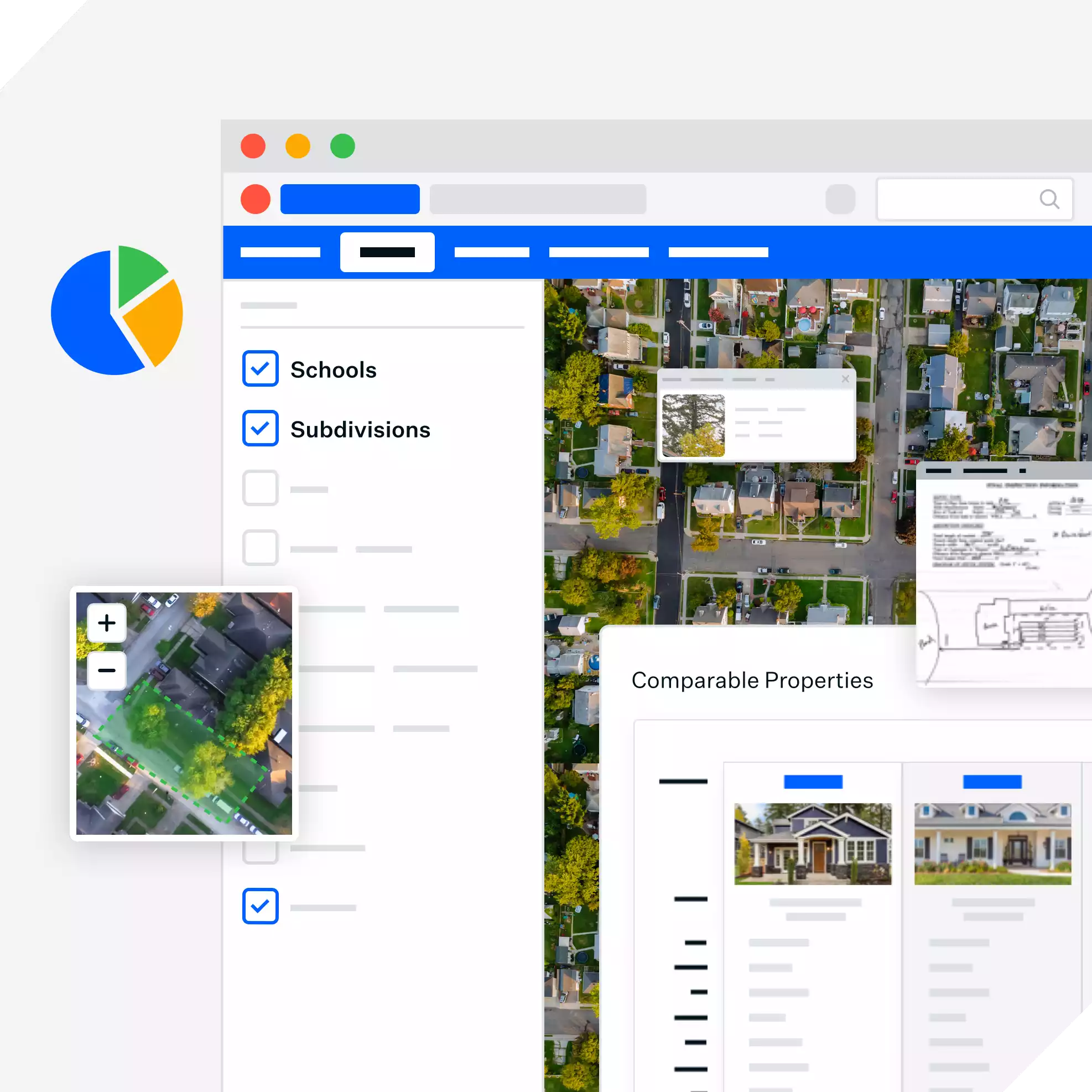

Before Schneider
After Schneider
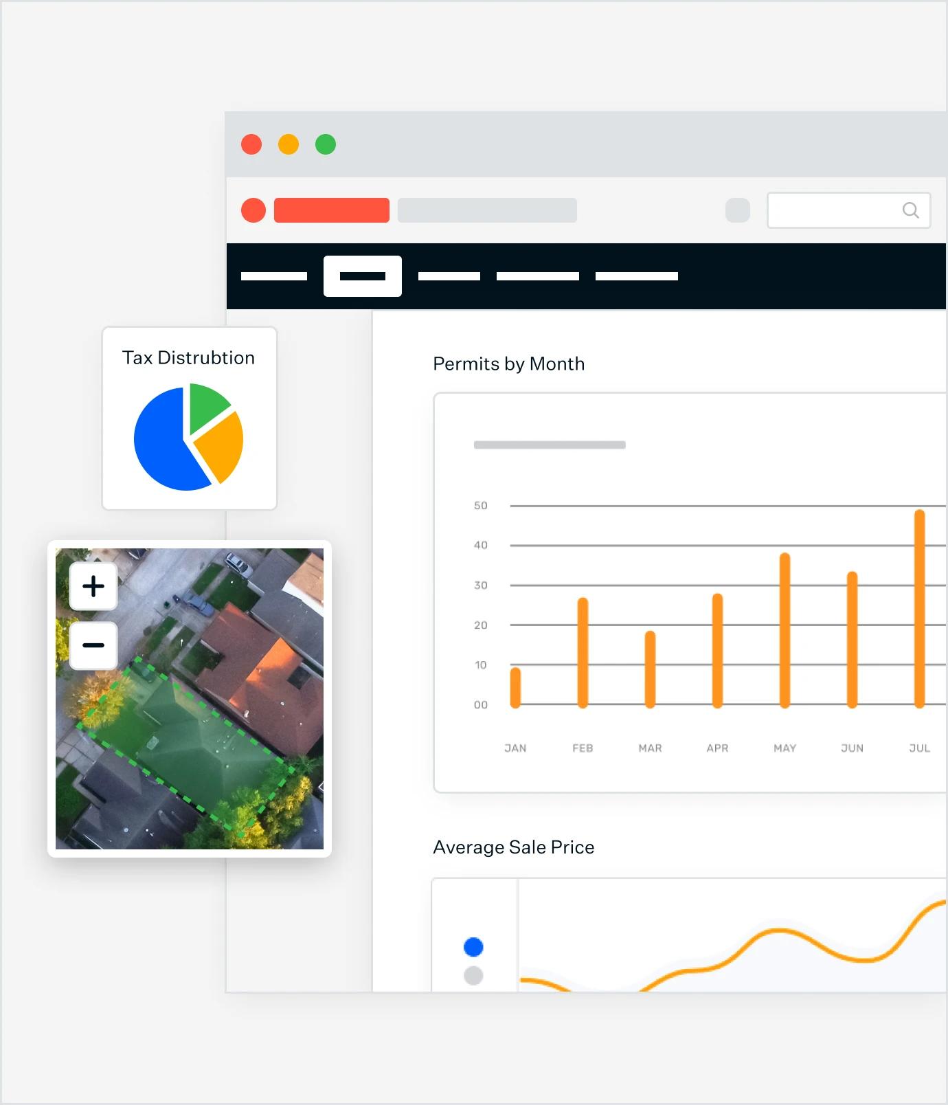
POWERFULLY UNIFIED INFORMATION
Seamlessly Compile and Analyze Data
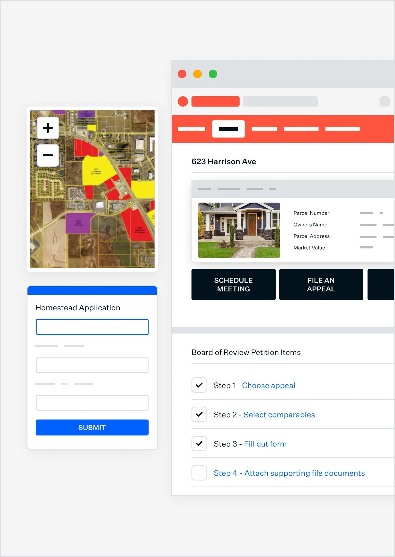
TAP + CLICK RESULTS
Find accurate, map-based information quickly
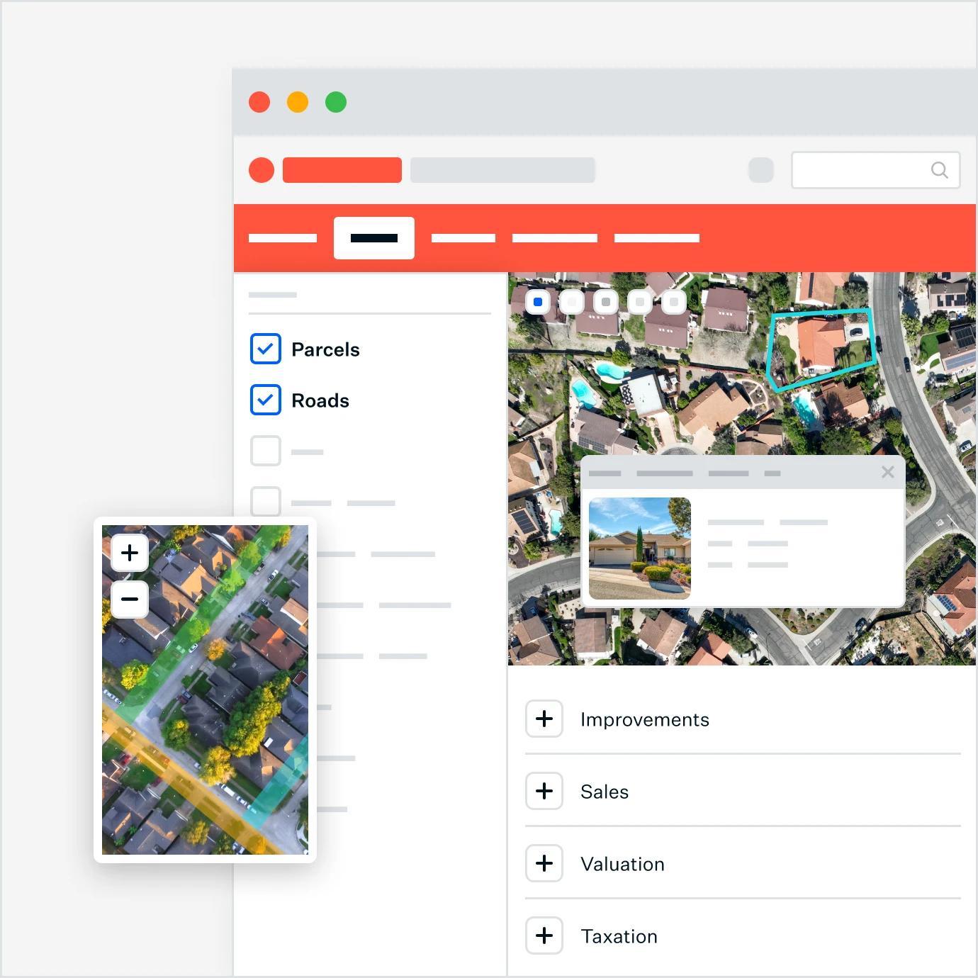
MAP DATA
Use map data to improve insights
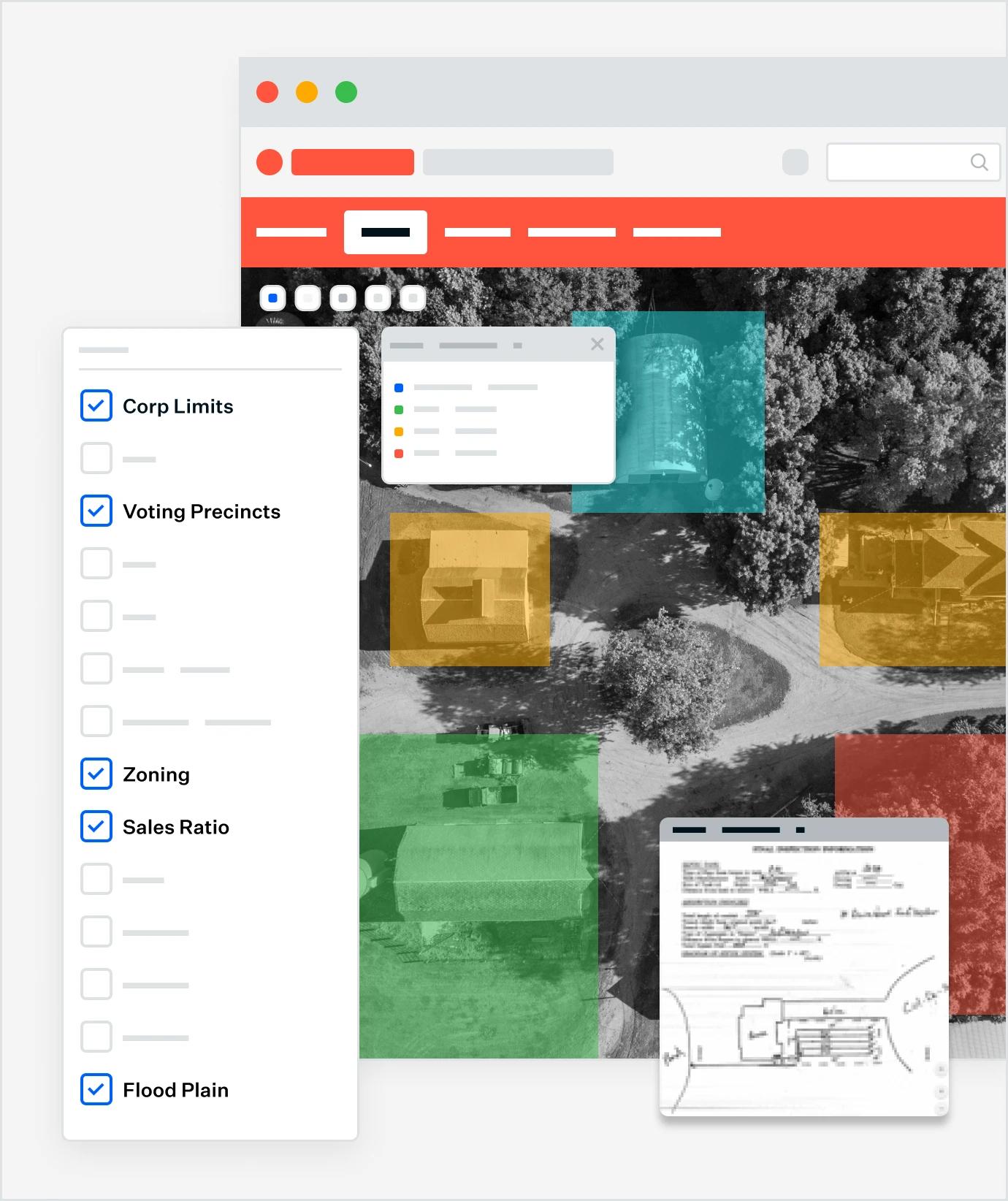
STANDARDIZE + ACCELERATE
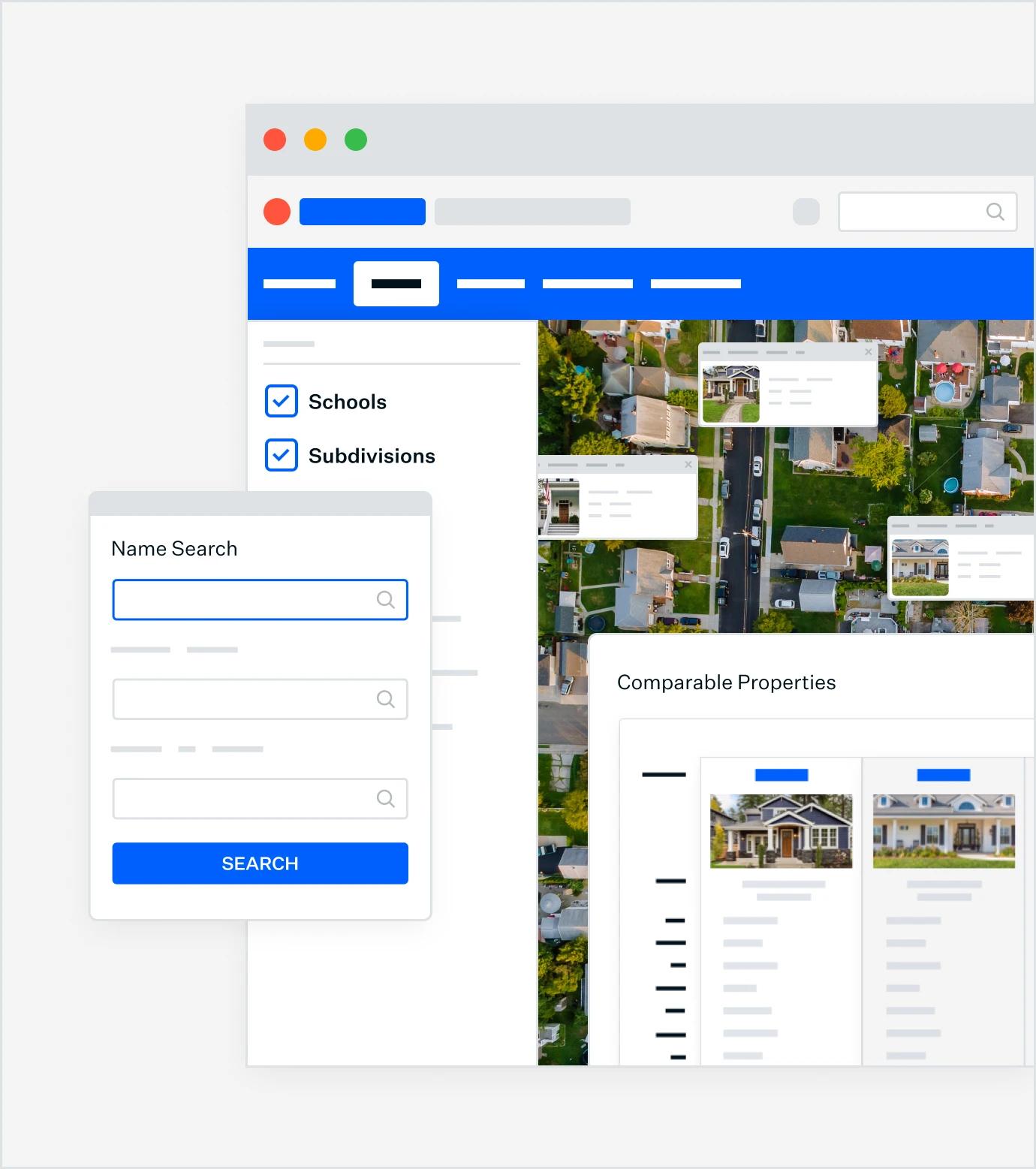
Leverage Your Data for Enhanced Citizen Experiences
EMPOWER CITIZENS
Put parcel data and documentation into taxpayers’ hands
Trusted by 1,000+
local governments
Our Solutions
A growing platform of GIS-integrated solutions
Have a question?
Contact our Sales Team
Permitting & Licensing
Make permits, licenses and applications easily accessible online. Discover affordable solutions for buildings, marriage, construction, electrical, alcohol, and more.


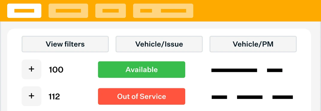
Asset Management
Discover powerful digital tools that make work more accurate and efficient. Find solutions for monitoring and managing fleet, work orders, permits, infrastructure, water systems, and more.
Schedule a 15-minute learning session.
We'll talk with you about best practices for Parcel Management, and the solutions other local governments are using, so you're fully informed.
Schedule now