
Platform
Highly efficient permitting and licensing tools for county and city governments
Transform your process for managing and enforcing permits and registrations into a fast, efficient workflow.
Request a Demo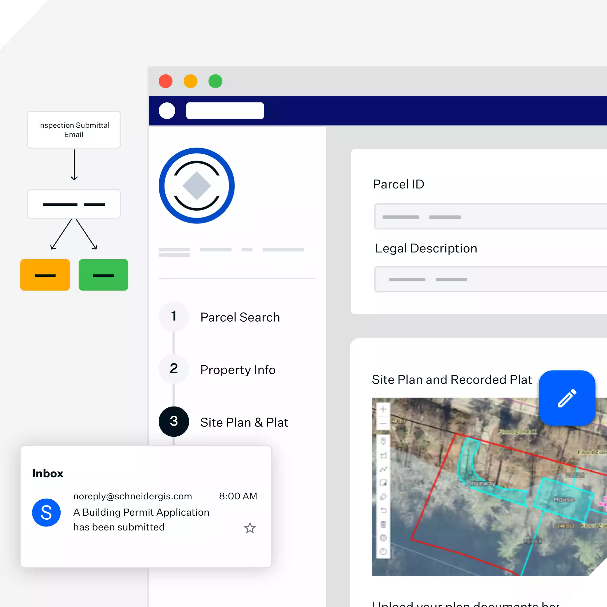

Before Schneider
After Schneider
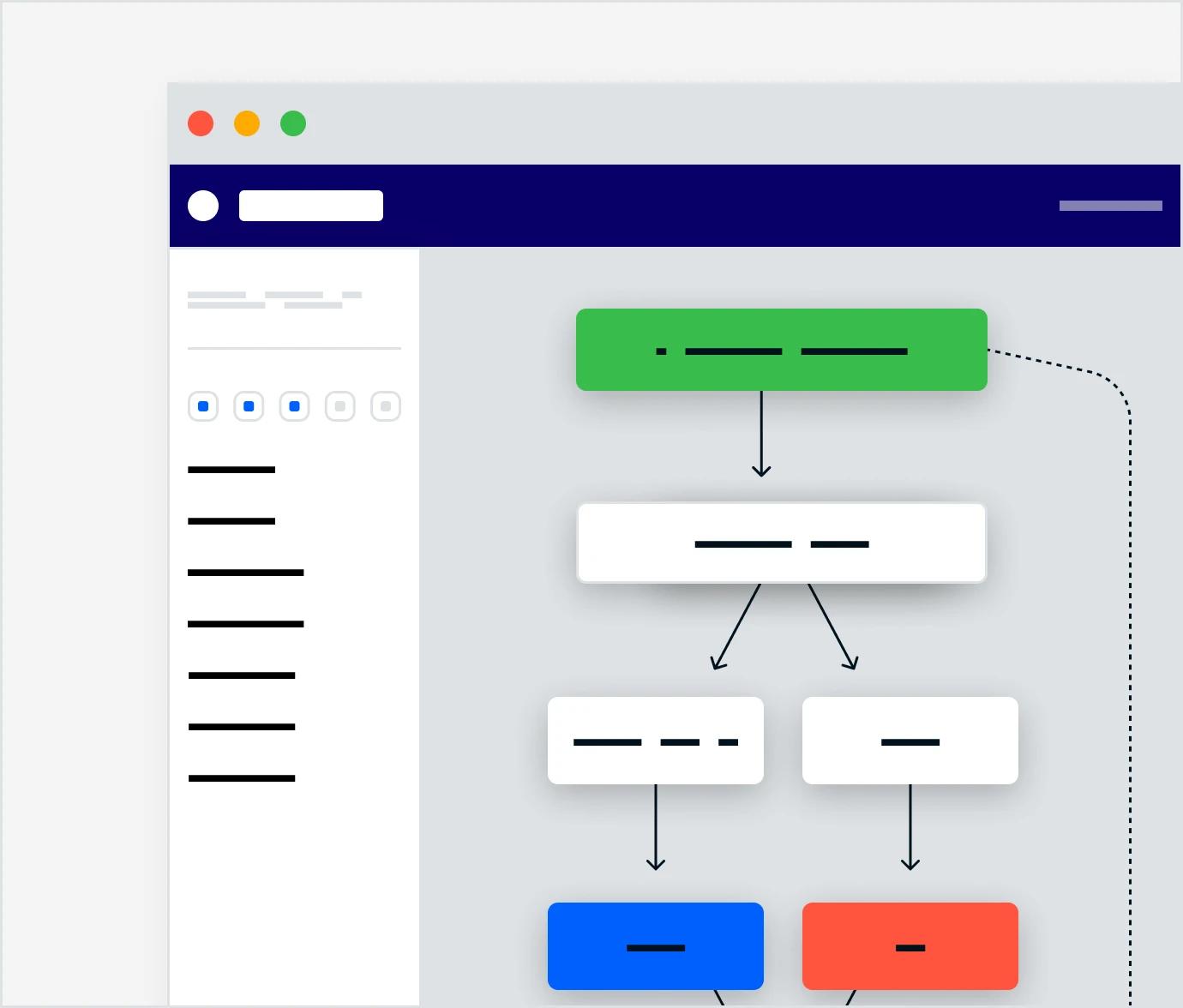
Management
EFFICIENT + TRANSPARENT
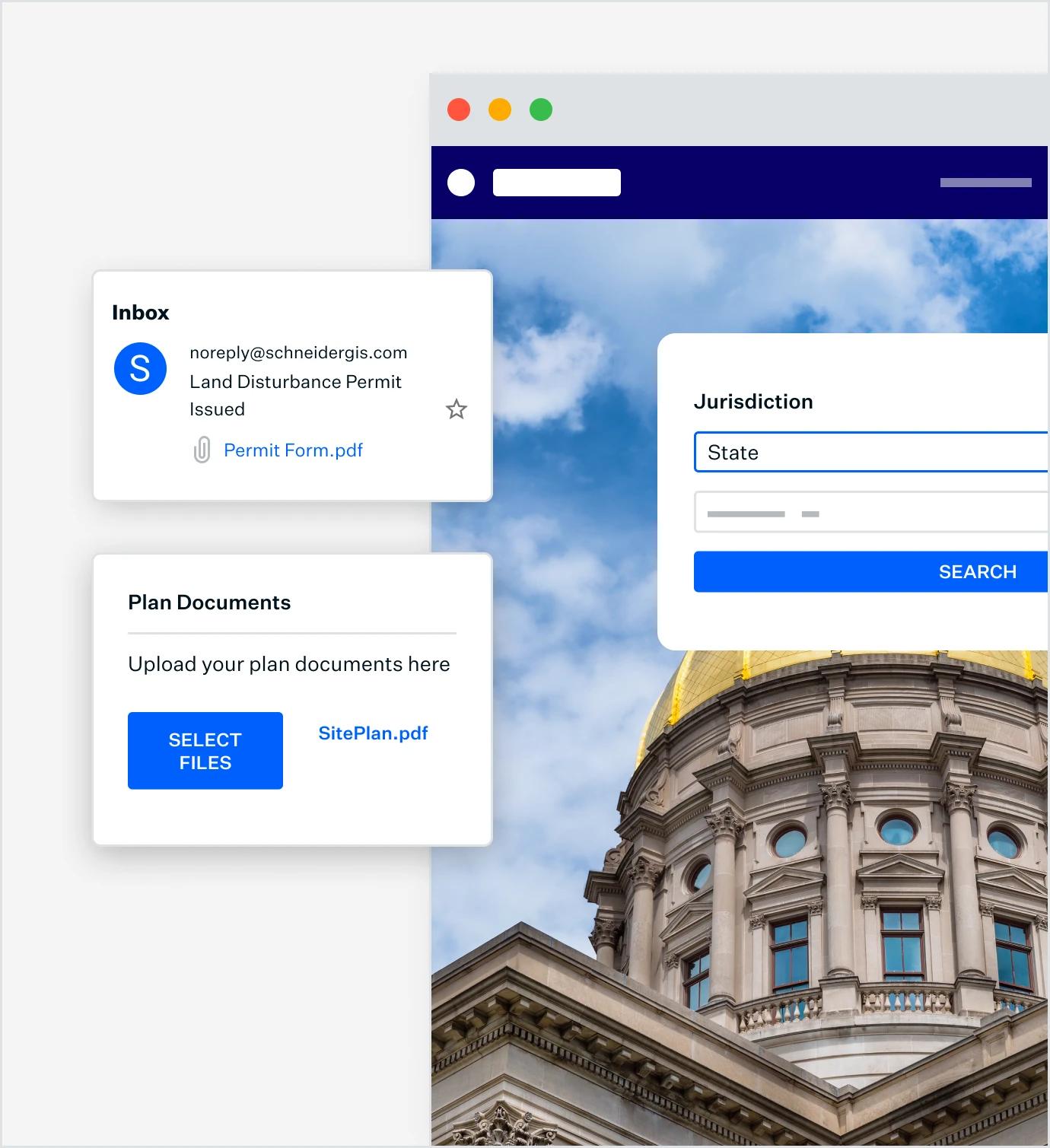
Create seamless permitting processes for staff and citizens
Save hours of time with online processes for managing permit applications, vendor registration, and code enforcement. We’ll create custom processes, forms, and fee collection tools to suit your community.
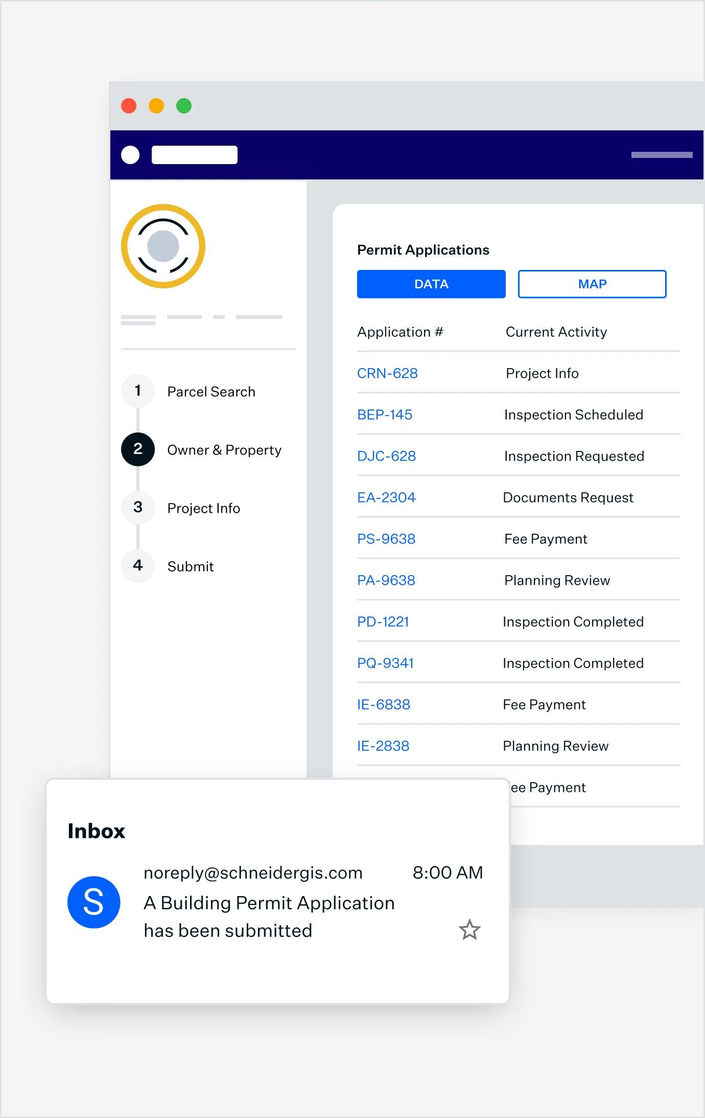
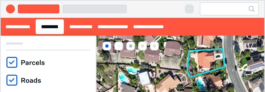
Visualization
VISUALIZE DATA
Your Data, Simplified
Harness the power of a map-based interface to search and locate permits effortlessly.
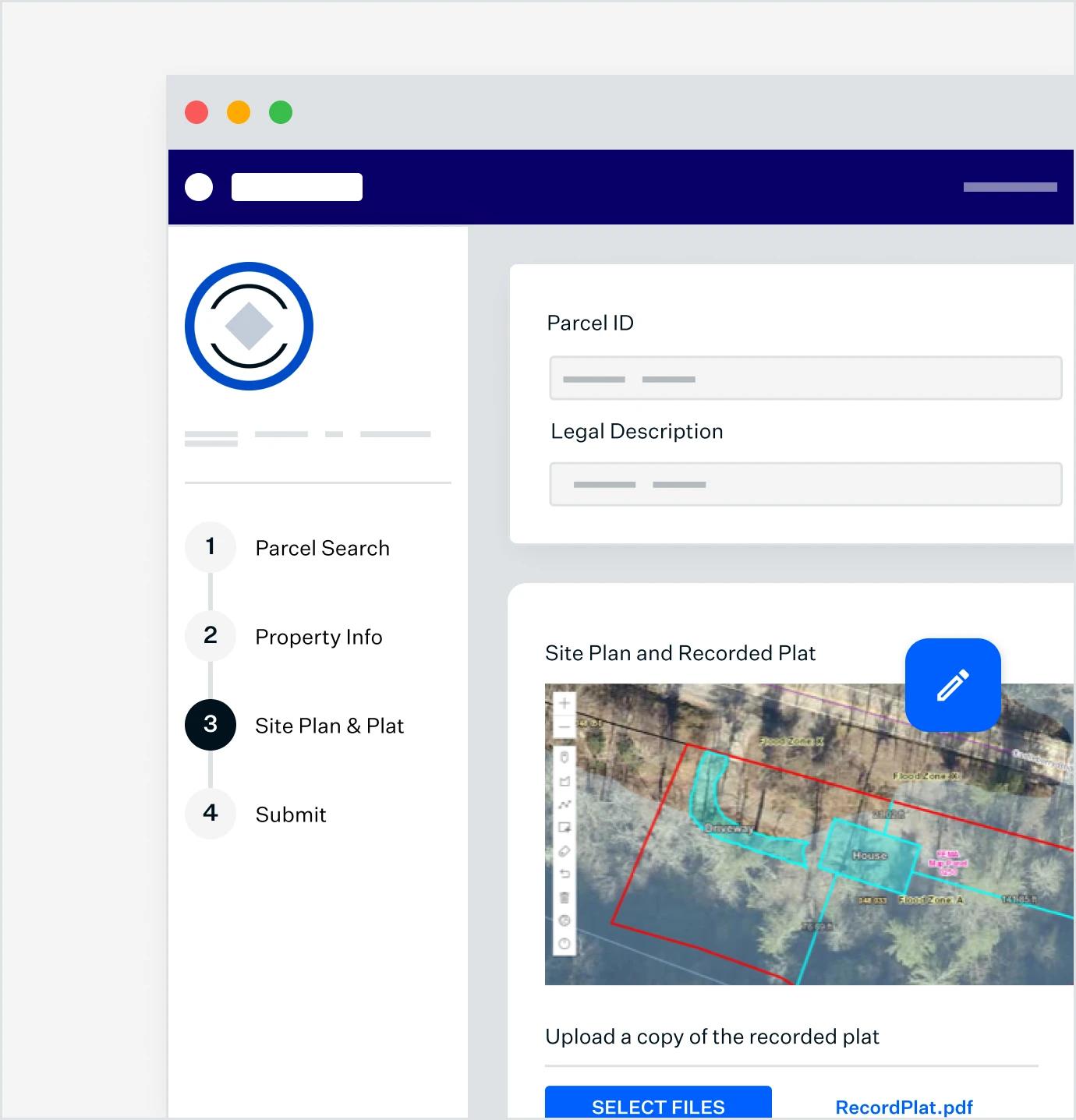
Experience
EASE-OF-USE
Streamlined and Customizable
Customize your permitting system to fit your specific requirements and workflows, enhancing efficiency and productivity.
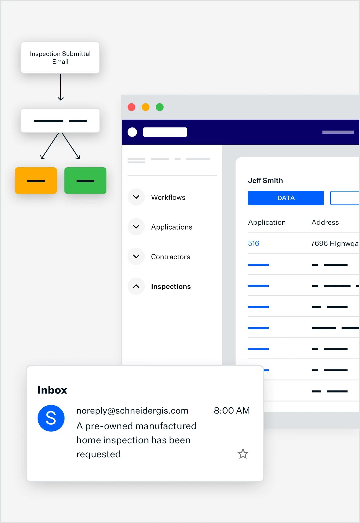
Experience
SUPERIOR ENGAGEMENT
Engaging and Intuitive
Enhance the experience for citizens filing permits and licenses, making it straightforward and user-friendly.
ADAPTABLE + COST-EFFECTIVE
Use Schneider Geospatial’s workflow management software for all permit types
Our system adapts to the needs of every permit or licensing process you manage. Rely on Schneider for Building, Engineering, Fire, Health, Construction, DPW, Business, and more.
Learn MoreTrusted by 1,000+
local governments
Our Solutions
A growing platform of GIS-integrated solutions
Have a question?
Contact our Sales Team
Parcel Management
Integrated information for better decision making and citizen engagement. Our platform integrates with CAMA, Tax Administration, and other systems, giving you unified tools for appraisals, appeals, sales searches, forms, and more.

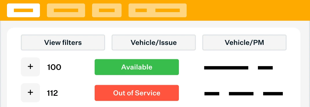
Asset Management
Discover powerful digital tools that make work more accurate and efficient. Find solutions for monitoring and managing fleet, work orders, permits, infrastructure, water systems, and more.
Schedule a 15-minute learning session.
We'll talk with you about best practices for Permitting & Licensing, and the solutions other local governments are using, so you're fully informed.
Schedule now