top of page

About

Schneider Geospatial partners with clients to create innovative solutions combining GIS and related technologies with exceptional customer service.​
 

​A technology leader and one of the largest providers of GovTech geospatial solutions in the US, Schneider Geospatial provides innovative, industry-leading solutions to help organizations get the most from their limited resources.

​

Examples include creative and award-winning product solutions such as Beacon™ and qPublic.net™ (local government information for the web), GeoPermits™ (cloud-based permitting and workflow management), IDAM™ (integrated damage assessment model), and Agland™ (automates the calculating process for agricultural assessments) to name a few. 


In addition to our diverse product portfolio, Schneider Geospatial offers a full range of GIS, technology, and GovTech services. Whether we are designing a new system for a client, converting paper or digital records into GIS, implementing new technology, providing staff training, or serving as/complimenting an organization’s GIS staff, Schneider Geospatial’s service level raises the bar for what our clients expect. In a third-party National Customer Satisfaction survey, Schneider Geospatial was rated "exceptional" or "one of the best" by virtually all respondents for reputation, customer service, product and service quality, and project execution.


Schneider Geospatial’s history dates back to 1962 with the founding of Schneider Engineering Corporation by Vincent Schneider. Built on the principles of high quality and excellent customer service, the company began offering GIS services in 1989. This entry paved the way for the future acquisitions of ProMap Corporation in 2005, qPublic in 2014, the Elevate product in 2020, and AccuGlobe product in 2021. The 2018 reorganization of Schneider Geospatial, into a separate business, positions the company for future growth and partnership with our clients.

Then in 2022, Schneider Geospatial announced that they received a significant growth investment from Align Captial Partners ("ACP"), a growth-oriented private equity firm focused on investing in companies who are well-positioned for growth, especially in the GovTech space. This fostering growth laid the groundwork for the subsequent 2023 acquisitions of WebGUIDE Xtreme (WGX) product of Applied Data Consultants, PeopleGIS, and Spatialest.
 

Awards & Achievements

Schneider Geospatial’s industry leadership has been recognized through several awards for projects and performance such as:

​

  • Esri Business Partner of the Year

  • Esri Foundation Partner of the Year

  • Esri 20 Year Partner Recognition Award

  • TechPoint Mira "Corporate Innovator of the Year" Winner

  • TechPoint Mira “IT/Tech Service Excellence & Innovation” Winner (GovTech)

  • TechPoint Mira "Large Enterprise of the Year" Finalist

  • TechPoint Mira "Tech Product of the Year" Finalist (Beacon/qPublic.net)

  • Best Places to Work in Indiana

  • IGIC Excellence in GIS Award (Marshall Co., IN)

  • IGIC Excellence in GIS Award (HSE Utilities)

  • IGIC Excellence in GIS Award (Roche Diagnostics)

  • IGIC Excellence in GIS Award (Town of Brownsburg, IN)

  • IGIC Excellence in GIS Award (Indiana State Lands Office GIS project)

  • ACEC Engineering Excellence Award (Vigo Co./City of Terre Haute GIS)

  • IGIC Excellence in GIS Award (Town of Plainfield, IN Sewer Integration project)

  • TechPoint Mira “Innovation of the Year” nomination (Draincalc)

  • ACEC Engineering Excellence Award (SAMCO/HSE Utilities)

  • IGIC Excellence in GIS Award (Eli Lilly, INDOT, & the City of South Bend GIS projects)

  • AIC Awards (Blackford Co., IN & Huntington Co., IN GIS projects)

  • IGIC Excellence in GIS Award (City of Indianapolis DWP Impervious Surface project)

  • IGIC Excellence in GIS Award (Town of Cumberland, IN and Huntington Co., IN web GIS projects)

  • And several Esri Special Achievement in GIS Awards.​

Nominee-Badge-2020.png
2024 Email Signature GETWFII.png
GovTech 100 2023 Circle copy.png
GovTech 100 2024 Circle.png

Schneider History

TSC

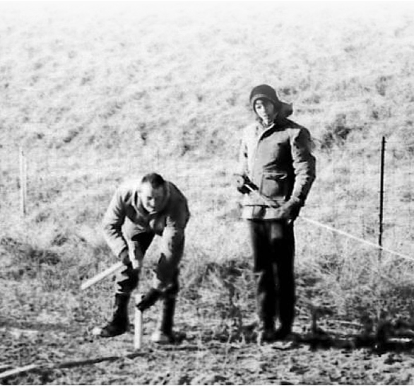
Vincent Schneider was a brilliant mathematician who discovered his love for land surveying and civil engineering while serving in World War II as a First Sergeant in an artillery battalion.​

​When he returned home from service, he was able to put himself through Purdue University on the GI Bill. Vince eventually became a licensed professional engineer and land surveyor and worked for a local development company in Indianapolis before deciding to open his own firm, Schneider Engineering  Corporation, on June 27, 1962. Schneider started from meager beginnings in a trailer on the East side of Indianapolis with a few men and a few pieces of surveying and calculating equipment. In those early years, Schneider primarily focused on residential and multi-family surveying and engineering projects in the Indianapolis area. Vince also had a love for technology and a talent for programming and he wrote some of the early coordinate geometry software for Hewlett Packard programmable calculators. Hewlett Packard eventually asked Schneider to serve as a retail outlet for their calculators and for approximately seven years Schneider sold calculators and eventually HP and other brand personal computers. of the largest organizations of its kind in the US. It also expanded Schneider more significantly in the Southeast part of the country. 

In 1968, Vince’s son, John Schneider, following graduation from the University of Notre Dame with a degree in engineering and two years of service in the United States Army including a year in Viet Nam, joined the firm. With John taking an active role in management, Schneider began to grow and expand its services into the public sector, locally and regionally, with surveying and engineering contracts with the City of Indianapolis and the U. S. Army Corps of Engineers. Following Vince’s retirement in 1982, John became President and CEO of Schneider and he and his wife, Marilyn, became owners. Under John’s leadership, Schneider further diversified its services and geographic locations adding a focus on commercial site design, the industrial and utility sectors. and expanding the government sector to include wastewater and transportation work. 
 
John was also instrumental in establishing Schneider’s culture. In the late 1980s, John was exposed to the writings and teachings of Robert Greenleaf who gave the name “Servant Leadership” to what John already believed and practiced as his leadership style. The basic tenets of Servant Leadership are that those people who possess a desire and passion to serve others, typically emerge as the most effective leaders because it is in serving others that they, in fact, lead.  
 
In 1989, Schneider began its Geographic Information Systems (GIS) department. GIS grew from a niche in the company to a core discipline.

In 1990, Schneider acquired the architectural firm of Bohlen, Meyer, and Gibson and began offering architectural services in the educational and religious niches. It later opened branch offices in Avon, Lafayette and Carmel, Indiana.
 
In the 1990s John and Marilyn’s children, J. Barry and Victoria, both graduates of the University of Notre Dame, began working at Schneider. Barry, following his grandfather and father’s footsteps, earned a degree in civil engineering and began work in 1990 as a project engineer.  Victoria graduated with a degree in political science and went on to earn a Juris Doctorate from Ohio Northern University School of Law. She joined Schneider in 1997 as general counsel and the director of human resources. Upon John’s retirement in 2002, Barry and Victoria became third-generation owners of Schneider along with Marilyn. In 2007, Schneider was designated a Women’s Business Enterprise (WBE) with the State of Indiana and the City of Indianapolis. Today Barry serves as Schneider’s Chairman of the Board and Victoria serves as its Chief Executive Officer. 

In 1997, Schneider began operating as The Schneider Corporation, and in 2001 moved its headquarters to its current location at Fort Benjamin Harrison in Indianapolis, Indiana. For the next several years Schneider continued to diversify geographically into Charlotte, North Carolina, and Nashville, Tennessee, where it offered an array of services from land surveying, site design, environmental engineering, wastewater design, transportation work, and GIS. 

Later in 2005, Schneider acquired the Ames, Iowa-based ProMap Corporation to form one of the largest GIS providers in the Midwest. Schneider increased its scope and capabilities by combining two of the largest GIS web-hosting services in the country under Beacon™. Schneider was able to offer a broader range of services and products to a wider market than ever before.

Then in 2014, The Schneider Corporation announced the acquisition of qPublic (based in DeLand, Flordia), a leading provider of geospatial and real estate web portals primarily in the Southeast. The acquisition created one of the largest organizations of its kind in the US. It also expanded Schneider more significantly in the Southeast part of the country. The popular qPublic.net web portal and IDAM™ (damage assessment software) became part of Schneider’s growing GovTech suite of solutions.

In 2018, The Schneider Corporation announced the reorganization of the company. Schneider Geospatial then spun out on its own. This move recognized the ongoing evolution of the businesses and allowed each to better serve its clients and employees. Schneider Geospatial continues to be an innovator and leader in GIS and technology.

​

In 2022, Schneider Geospatial announced that they received a significant growth investment from Align Capital Partners ("ACP"), a growth-oriented private equity firm focused on investing in companies who are well-positioned for growth, especially in the GovTech space.

​

“We are excited to continue our partnership with our amazing clients,” said Jeff Corns, CEO of Schneider Geospatial, “ACP’s investment allows us to accelerate several of our growth initiatives which will result in even better solutions and services to our clients. Our talented team is excited to continue this next phase of the Company’s growth.”

WHAT PEOPLE SAY

“I’ve been so impressed by your own availability, your time devoted to clear explanation and problem-solving, your follow up, follow through and your exemplary professionalism.  You’ve made it so easy to work with Schneider Geospatial.”​


—  Delisse Locher, Assessor

     Town of Washington, Connecticut

ProMap

ProMap History

PMC, ProMap Corporation was founded in 1991 by Bob Mortensen and Tim Shuck, following their leadership of the Iowa Cooperative Soil Survey soil map digitizing project at Iowa State University in the late 1980s.

​​

After digitizing over 30 million acres of soils data, Mortensen and Shuck realized that counties lacked the tools to leverage this digital asset. After two years of research and development, ProMap invited several Iowa counties to a presentation on how they could use GIS for land assessment and signed their first county client in 1993 with others quickly following. The company began converting data such as the USPLS, parcels, land use, roads, and rights-of-way into GIS format. In 1994, ProMap released PMCtract, its first parcel management solution, followed by other software solutions such as PMCpro and PMCgis (the foundation of Agland and Geogear today).


In addition to serving the local government market, ProMap was also an early leader in the precision agriculture market, developing solutions such as GIS/GPS-based variable rate application controllers and software; GIS/GPS enabled soil sampling; and crop scouting software. ProMap partnered with several local and regional distributors, serving early adopters in the market. When the large equipment manufactures entered the market, ProMap served as the mapping extension of a global market leader, until the company decided to exit the precision ag market to focus exclusively on the local government market.


After building local government GIS for several dozen counties in Iowa, Minnesota, South Dakota, Missouri, and Kansas, ProMap saw a need to help local governments publish and share this information on the web. Then in 1998, ProMap created its first GIS web portal, the foundation of what would become Beacon/qPublic.net today. Additional tools followed, all designed to help local governments better utilize their GIS resources. During this period, ProMap also provided countless hours of support, training, and leadership in the Midwest GIS market.


In 2000, ProMap began a business partnership with The Schneider Corporation to allow Schneider to resell ProMap’s PMCgis tools to local governments in Schneider’s market. That partnership lead to the eventual acquisition of ProMap by Schneider in 2005, creating one of the largest GIS solutions providers to local governments in the Midwest.

ProMap.jpg

Our Mission

Schneider Geospatial partners with clients to create innovative solutions combining GIS and related technologies with exceptional customer service.

qPublic
qpublic-1st-booth.png

qPublic History

Jim Gear was a Property Appraiser, from 1993 to 1996, for Leon County, Florida.

​​

He was tasked to make their property record cards available to the public via a new website. Jim managed to do so and was one of the first in the nation, if not the first, to accomplish this when he launched their new website on January 24, 1995.

After moving to DeLand, Florida in 1996, Jim went to work for the Volusia County Property Appraiser Office, where once again he was asked to put their data online.

This time, Jim engaged a software engineering class at the Emery Riddle Aeronautical University (ERAU) being taught by Steve Lehr. After a few months, the Property Appraiser’s new search capability was fully functional.

A few years later, Jim decided to build these types of websites as a business. Thus, qPublic, LLC was founded in 1999, in DeLand Florida, by Jim Gear, Steve Lehr, Tim Olson, and John Cox. Jim came out of the Property Assessment world, Steve was the programmer, Tim was an initial investor, and John had been building websites commercially since 1993. Therefore, qPublic.net was born.  

It wasn’t long before qPublic.net was providing services to a dozen Florida counties, all of which were using AS400s for their CAMA software. qPublic launched Bibb County, Georgia soon after, and also created and maintained websites for the Property Appraiser Association of Florida and for the Florida Association of Property Appraisers in an effort to meet these folks and become “known”. qPublic actually managed the website for IAAO for a period, July 2000-2002.

In November 2001, qPublic put the first maps online using Mapserver (3.3) software. This added feature brought in more and more county websites. The data from the CAMA system was the most important thing for the public.

In 2003, qPublic’s founder Jim Gear passed away. Jim’s wife Nancy joined the organization and Steve and John took on additional responsibilities.

Perseverance paid off; qPublic was soon expanding across Georgia and into South Carolina and Kentucky. The popular “Not a Dime” program allowed smaller counties with no available money in their budget to have a website that was subscription-based. The fees to the public were very affordable and the Assessor’s office still got the benefit of the website, helping their “door not swing and their phone not ring”.

Having reached a county count of approximately 300 clients in 15 states, qPublic was the largest provider of web services to Assessors in the nation. To allow for the retirement and exit of some of the principals, qPublic was acquired by The Schneider Corporation in June 2014. 


Currently, Schneider Geospatial works with over 600 counties in 28 states. The acquisition creates one of the largest organizations of its kind in the US. 

Business People Applauding

We are honored that Schneider Geospatial has been named one of the Great Employers to Work for in Indiana 2023 by Best Companies Group. 

​

Schneider Geospatial was selected based on a detailed, anonymous survey of its employees, as well as an analysis of the company's workplace policies, practices, and demographics. Best Companies Group's annual award program analyzes our team’s responses about corporate culture, training and development, salary and benefits, and overall employee satisfaction to determine selection.

​

Congratulations to all of our employees for all your hard work and dedication to making this company great! As the results are based on the independent feedback from our own team members; we want to thank everyone for promoting our core values by making this achievement possible.

Elevate History

elevate logo side-by-side.png

Elevate was launched around 2005 in Bloomington, Indiana. Since then it underwent 4 major rewrites in a decade span from 2010-2020. Elevate received multiple international achievement awards from Esri, the world leader in the rapidly expanding industry of geographic information system (GIS) software.

​

Elevate provided easy internet access to a digital courthouse—a comprehensive suite of local information including property records, tax assessments, zoning regulations, plat maps, and other forms of data. This intuitive system, which delivered more than 800,000 maps on a daily basis in 2020, uses geographical layers to help visualize information. Elevate proved particularly useful during the COVID-19 health crisis, making it possible for county employees to enter and edit information remotely while allowing users to access the records they need from the comfort of their homes at any time of day.

​

​By 2020, Elevate provided over 125,000 registered users in 17 Indiana counties. It was during this time, Schneider Geospatial announced the acquisition of the Elevate platform and local-government consulting practice from 39 Degrees North (39ºN). This acquisition expanded Schneider Geospatial's Indiana county client base to include over two-thirds of the state.

AccuGlobe History

Developed by Digital Data Technologies, Inc (DDTI) and launched in December of 2003, AccuGlobe was the flagship product in the State of Ohio. Many local governments relied on its powerful ability to disseminate their data to a wider base to promote data exploration for users with all levels of experience.

​

​In 2021, AccuGlobe had 45 SaaS sites across Ohio. Once the AccuGlobe Internet web portals were integrated into Schneider Geospatial’s popular and industry-leading Beacon™ platform the Ohio county client base grew to over half of the state, while continuing Schneider Geospatial's national expansion strategy.

elevate
accuglobe
bottom of page